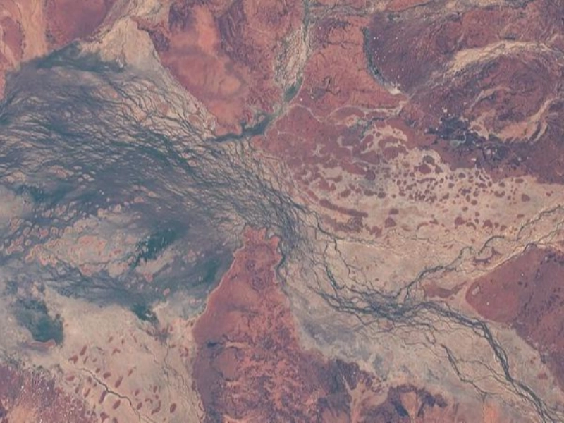
The Cooper Creek floodplain, located in Australia, is a remarkable ecosystem that showcases the dynamic interplay between water and land. This region is characterized by its seasonal flooding, which supports a rich diversity of plant and animal life. NASA's Johnson Space Center, particularly through its Earth Science and Remote Sensing section, utilizes advanced satellite technology to study areas like the Cooper Creek floodplain. By capturing high-resolution images and data, scientists can monitor environmental changes, assess water resources, and understand the impacts of climate variability on this vital ecosystem. The insights gained from remote sensing not only enhance our understanding of the Cooper Creek floodplain but also contribute to broader efforts in conservation and sustainable management of Australia's unique landscapes.
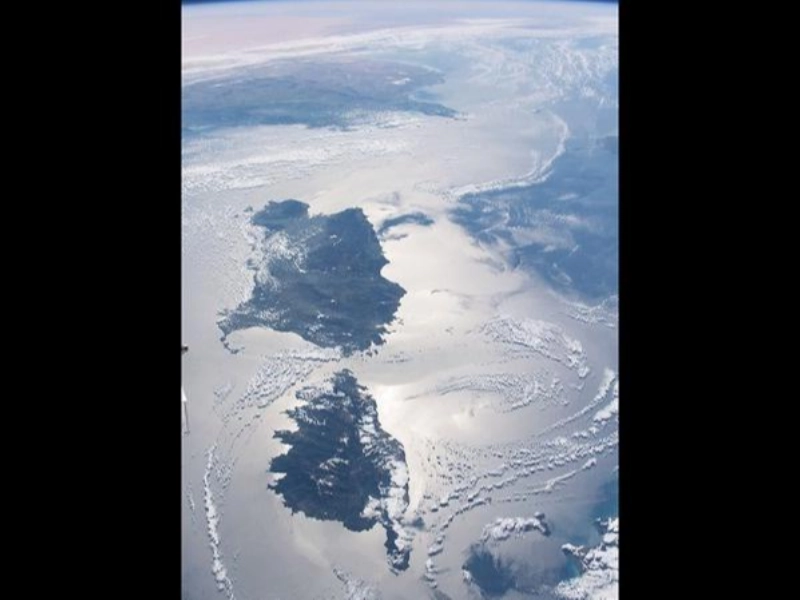
The islands of Corsica and Sardinia, nestled in the Mediterranean Sea, are breathtakingly highlighted by sunlight reflecting off the water's surface. This stunning view captures the unique beauty of these islands, known for their rugged coastlines, lush landscapes, and rich cultural heritage. The Earth Science and Remote Sensing Division at NASA's Johnson Space Center plays a vital role in studying such picturesque regions. Utilizing advanced satellite imagery and remote sensing technologies, scientists can analyze the environmental conditions of Corsica and Sardinia, monitoring factors such as vegetation health, land use changes, and the effects of climate change. By leveraging these cutting-edge tools, researchers gain valuable insights into the Mediterranean ecosystem, helping to inform conservation efforts and sustainable practices that protect these beautiful islands for future generations.
Advertisement
Recommended Reading: These Animal Photos Are So Flawless, You’ll Think They’re Edited
You are viewing page 2 of this article. Please continue to page 3


Feels transferable instantly.
You’ve distilled noise into signal.
Nice balance of ideas. Missing anything?
Supports emergent layering gracefully.